
Architects routinely face a fundamental challenge: obtaining accurate three-dimensional spatial data that faithfully represents existing structures and environments. Traditional measurement methods often fall short, introducing errors that compound throughout a project’s lifecycle and compromise design integrity. Manual surveys consume valuable time, and conventional photography lacks the dimensional precision required for complex renovations or heritage-sensitive work. Virtual museums have emerged as a transformative solution, harnessing digital technology to create exhaustive spatial records of physical spaces with unprecedented fidelity. By integrating 3D LiDAR mapping with point cloud data, these digital environments enable architects to generate precise models that capture every surface, contour, and architectural detail. This convergence of scanning technology and data processing offers professionals a streamlined pathway from raw spatial capture to finished deliverables. The result is a simplified workflow that reduces rework, enhances collaboration, and ensures that every design decision rests on a foundation of verified, millimeter-accurate information.
Understanding Virtual Museums and Their Architectural Significance
Virtual museums are comprehensive digital replicas of physical spaces, constructed through advanced scanning technologies that capture geometry, texture, and spatial relationships with extraordinary precision. What began as efforts to digitally preserve endangered cultural heritage sites has evolved into a robust architectural resource. Institutions worldwide now maintain detailed three-dimensional records of historically significant buildings, interiors, and artifacts—creating accessible repositories that transcend geographic and temporal limitations.
For architects, these digital environments serve a dual purpose. They provide richly detailed spatial references for renovation projects, adaptive reuse schemes, and heritage-sensitive designs where understanding original construction methods and proportions is essential. Rather than relying on incomplete archival drawings or conducting repeated site visits, professionals can interrogate a virtual museum’s data to extract measurements, study material conditions, and analyze structural configurations remotely. This capability proves particularly valuable when working with protected landmarks where physical access is restricted or when coordinating across international teams. Virtual museums effectively bridge historical accuracy and contemporary design ambitions, giving architects a verified spatial foundation upon which to layer new interventions without compromising the integrity of what already exists.
Core Technologies: 3D LiDAR Mapping and Point Clouds for Precision
Three-dimensional LiDAR mapping operates by emitting rapid laser pulses toward surfaces and measuring the time each pulse takes to return to the sensor. This time-of-flight calculation, repeated millions of times per second, generates spatial coordinates with millimeter-level accuracy across vast areas. Unlike photogrammetry, which reconstructs geometry from overlapping photographs and depends heavily on lighting conditions, LiDAR functions independently of ambient light and captures true geometric relationships without interpretive algorithms introducing distortion. For architectural applications, this distinction matters enormously—structural assessments, façade documentation, and interior surveys all demand dimensional certainty that photographic methods struggle to guarantee consistently.

Point clouds represent the raw output of these scanning operations: dense collections of individual data points, each defined by X, Y, and Z coordinates and often enriched with intensity values or RGB color information. A single scan of a moderately sized building interior might produce tens of millions of points, collectively describing every visible surface with sufficient resolution to discern ornamental details, structural deflections, and material transitions. When architects work with point cloud data derived from virtual museum projects, they gain access to spatial records that preserve conditions at a specific moment in time—an invaluable baseline for monitoring change, planning interventions, or reconstructing lost elements. The synergy between 3D LiDAR mapping and point cloud processing creates a closed loop of capture and interpretation, where high-accuracy mapping feeds directly into modeling environments capable of transforming raw coordinates into intelligent architectural assets.
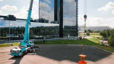
How 3D LiDAR Mapping Enhances Accuracy in Architectural Projects
LiDAR scanning deployments typically involve terrestrial tripod-mounted units for static captures or handheld devices for rapid walkthroughs of complex spaces. Terrestrial scanners deliver the highest point density and positional accuracy, making them ideal for heritage documentation where sub-millimeter fidelity is non-negotiable. Mobile systems sacrifice marginal precision for speed, covering large floor areas in minutes rather than hours. Environmental considerations—reflective surfaces, extreme temperatures, and dust—require operators to adjust scan settings and plan station placements strategically. Compared to traditional tape-and-total-station surveys, LiDAR eliminates selective measurement bias by capturing everything within its field of view simultaneously, producing comprehensive datasets rather than sparse point samples that require interpolation.
Point Clouds: The Foundation of Detailed and Accurate Models
Point cloud density determines the level of architectural detail recoverable from scan data. High-density clouds resolve fine moldings, joint patterns, and surface irregularities that lower-resolution captures miss entirely. Color information mapped onto each point from integrated cameras provides visual context that aids material identification and condition assessment during later modeling phases. Processing these massive datasets presents computational challenges—file sizes routinely exceed several gigabytes, demanding specialized software capable of intelligent decimation without sacrificing critical geometric features. Architects benefit from investing in structured processing pipelines that clean noise, remove transient objects like pedestrians, and register multiple scan positions into unified coordinate systems, ensuring the resulting point cloud serves as a trustworthy spatial foundation for every downstream deliverable.
Step-by-Step Guide to Creating Accurate Models with Virtual Museums
Translating raw scan data into polished architectural deliverables requires a structured approach that balances technical rigor with practical efficiency. The following workflow guides architects from initial capture through final presentation, ensuring that each phase builds upon verified spatial information while minimizing redundant effort.
Step 1: Data Acquisition Using 3D LiDAR Scanning
Successful scanning begins with thorough site planning. Walk the space beforehand to identify obstructions, reflective materials, and areas requiring overlapping coverage. Select scanner type based on project scale—terrestrial units for detailed heritage interiors, mobile devices for expansive floor plates. Establish control points using survey targets to anchor scans within a known coordinate system. Capture systematically, ensuring at least thirty percent overlap between adjacent scan positions so registration software can align datasets reliably. Document environmental conditions and scanner settings for each station to maintain a clear audit trail.
Step 2: Processing and Aligning Point Cloud Data
Import raw scan files into dedicated processing software and begin by removing noise—stray points caused by airborne particles, reflections, or moving objects. Apply statistical outlier filters to isolate genuine architectural surfaces. Register individual scans using target-based or cloud-to-cloud alignment algorithms, verifying that residual errors remain below project tolerance thresholds. Decimate selectively in areas where extreme density adds no interpretive value, preserving full resolution around ornamental features and critical junctions. Export the unified, cleaned dataset in an interoperable format ready for modeling teams.
Step 3: Building Digital Twins from Point Clouds
Convert aligned point clouds into intelligent models by tracing geometry onto the scan data within BIM or mesh-modeling platforms. Assign material properties, structural classifications, and parametric relationships to transform static coordinates into dynamic digital twins. These twins support real-time simulation of lighting, thermal performance, and structural loading—enabling architects to test design modifications against verified existing conditions before committing resources on site.
Step 4: Integrating Virtual Tours for Enhanced Presentation
Generate interactive virtual tours by rendering the completed model within immersive platforms that allow clients and stakeholders to navigate spaces freely. PropTech companies like Realsee have advanced this capability by combining spatial capture with intuitive virtual tour interfaces, making it easier for teams to embed annotation layers highlighting proposed interventions alongside existing conditions captured from the virtual museum dataset. This approach communicates design intent clearly, accelerates approval cycles, and maintains a direct link between presentation visuals and the underlying high-accuracy spatial data.
Tools and Workflows for a Simplified Architectural Process
Selecting appropriate tools and establishing repeatable workflows determines whether point cloud projects deliver value efficiently or become mired in technical complexity. Architects who invest time in configuring their technology stack around interoperability and automation find that subsequent projects benefit from dramatically reduced processing overhead and fewer coordination errors between disciplines.
Essential Software for High-Accuracy Mapping and Model Creation
Point cloud processing demands software capable of handling billions of coordinates without sacrificing responsiveness. Cloud-based platforms have become increasingly practical, allowing teams to upload raw scan data and access cleaned, registered datasets from any location without taxing local hardware. For registration and noise removal, dedicated packages offer automated alignment algorithms that detect overlapping geometry between scan stations and minimize positional drift across large datasets. Once cleaned data is ready for modeling, BIM authoring tools with native point cloud support let architects trace geometry directly onto scan references, maintaining dimensional accuracy throughout the documentation process. Mesh generation software bridges the gap for organic or highly irregular forms that resist parametric description, converting dense point clusters into watertight surface models suitable for analysis and fabrication. Visualization engines then transform these technical assets into rendered experiences, supporting virtual tour creation and real-time walkthroughs that communicate spatial qualities to non-technical stakeholders.
Best Practices to Streamline Your Workflow and Overcome Challenges
Begin every project by defining accuracy requirements and deliverable formats before scanning commences—this prevents collecting unnecessary data while ensuring critical areas receive adequate coverage. Establish a consistent file naming convention and folder structure that all team members follow, reducing confusion when multiple scan sessions feed into a single unified model. Automate repetitive tasks wherever possible: batch processing scripts for noise removal, template-based registration workflows, and preset export configurations all eliminate manual steps that introduce human error. Schedule regular quality checkpoints where processed data is compared against known control measurements, catching drift or misalignment before it propagates into downstream models. Finally, maintain clear communication channels between scanning technicians, modelers, and design leads so that questions about ambiguous scan data receive prompt resolution rather than generating assumptions that require costly corrections later.
Embracing Spatial Accuracy for the Future of Architectural Practice
Virtual museums, 3D LiDAR mapping, and point cloud technology collectively represent a paradigm shift in how architects obtain, process, and leverage spatial data. By capturing millions of precise coordinates in a single scanning session, these tools eliminate the uncertainty inherent in traditional measurement approaches and provide a verified geometric foundation for every subsequent design decision. The workflow from raw capture through processed point clouds to intelligent digital twins offers architects a streamlined path that reduces rework, accelerates project timelines, and supports confident collaboration across distributed teams. The ability to interrogate detailed spatial records remotely—whether for heritage renovation, adaptive reuse, or new construction adjacent to existing structures—fundamentally changes what is achievable within typical project constraints. Looking ahead, artificial intelligence will further transform these workflows by automating object recognition within point clouds, predicting material degradation patterns, and generating preliminary BIM elements directly from scan data with minimal human intervention. As scanning hardware becomes more portable and processing moves increasingly to cloud infrastructure, adoption will expand beyond specialized firms into everyday practice. Architects who embrace these technologies now position themselves to deliver superior accuracy, communicate design intent more effectively, and respond to complex project demands with confidence grounded in verified spatial truth.